I recently used my Mavix Pro with a mapping software call Drone Deploy to capture a jobsite status for a friend. Their app allows you to set a specific waypoint that is setup with large amounts of overlap and takes pictures automatically. Their free plan allows you to do 5 rendered maps a month, so I thought I would try it on a new neighborhood currently under construction. Here is my first attempt:
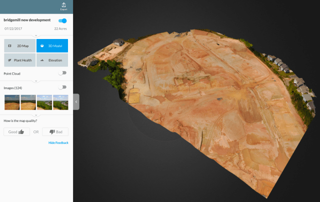
The app simply allows you to set a specific area that you want to cover, but you use the Mavic normal software to takeoff and setup. When you are ready to record the images for the 3D render you start Drone Deploy and start your flite. The app sends the path to the drone and the drone follows and snaps pictures automatically (as well as recording the GPS positions when the images were taken). When it was done I had it come back and land. Success.


